Roxburgh Gorge Flora
The Roxburgh Gorge presents a unique environment, formed after significant tectonic fracturing that resulted in the draining of Lake Manuherekia in Central Otago 16–18 million years ago. It was the home of water birds, fish, crocodilians and eucalyptus trees and the climate at the time was much warmer, almost sub-tropical. The climate now is temperate semi-arid and the 4-500m deep gorge provides shelter from prevailing westerly winds; it has a wide diurnal range of temperature, cold (-8 to -12°C) winters and hot (+25 to +40°C) summers and little rainfall (300-400mm p.a.), and wind and frost are significant erosive agents.
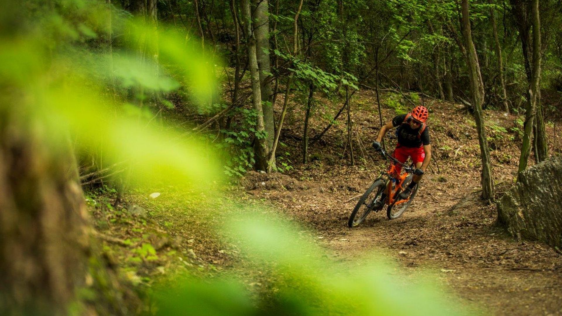
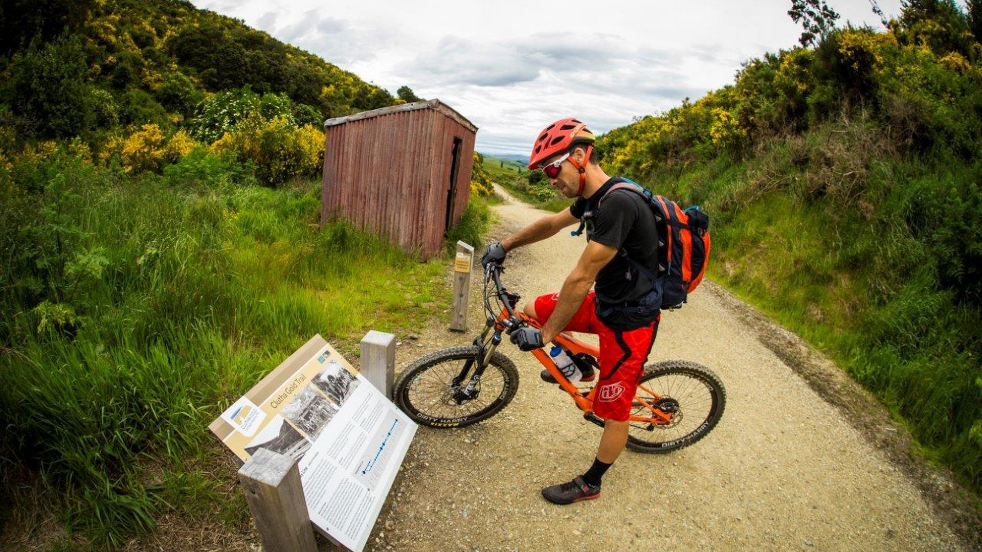
Riders and walkers on the Roxburgh Gorge trail will experience flora and fauna that is unique to Central Otago as it has been largely isolated from human activity other than iwi passing through enroute to and from pounamu fields, sporadic goldmining in the late 1800’s, early 1900’s, and restricted stock grazing.
Flora - Exotic
During summer the scent of invasive wild thyme (Thymus vulgaris), an early garden escape now widespread in the gorge, pervades the air and its flowers colour the hill slopes with a blue sheen, and tree lupin (Lupinus arboreus) colours the river margins yellow, as does Chinese clematis (Clematis tangutica) scrambling among the trackside vegetation. Willows (Salix fragilis) and silver poplar (Populus alba) grow along the riparian zone of Lk Roxburgh and isolated groups of Lombardy poplar (Populus nigra “Italica’) often indicate an historical dwelling site.
Mid and lower slopes are extensively covered in thyme dominated shrubland along with a range of other dry-tolerant exotic herbs and shrubs such as sweet briar (R. rubiginosa), broom (Cytisus scoparius), gorse (Ulex europaeus), Californian poppy (Eschscholzia californica) and wild mignonette (Reseda luteola). Despite the obvious impact of exotic plant species, some 53% of vascular species present are indigenous.
Flora - Indigenous
Travelling south, the trail increasingly passes through intermittent stands of woody kanuka (Kunzea syn. Leptospermum ericoides) and kowhai (Sophora microphylla). ‘Cromwell’ broom (Carmichaelia compacta) and desert broom (C. petriei), along with various shrubby species of Coprosma, Olearia, Ozothamnus, Pimelea and Hebe, grow on the lower slopes. More depleted areas amongst the thyme support mats of native scabweed (Raoulia australis).
Steep rocky outcrops separate the upper face from the lower slopes. Shrubland often surrounds the larger outcrops and is dominated by mingimingi (Coprosma propinqua), Olearia odorata, mountain cottonwood (Ozothamnus vauvilliersii), bush lawyer (Rubus schmidelioides), matagouri (Discaria toumatou), porcupine shrub (Melicytus alpinus), and occasional O. lineata and koromiko (Hebe spp). Ledges and crevices on rocks support anisotome (A. cauticola), desert pimelea (Pimelea aridula) and gorge-dwelling hebe (Hebe pimeleoides subsp. faucicola).
Many native grasses can be seen growing in the thyme along the trail, including blue tussock (Poa colensoi), blue wheatgrass (Elymus apricus), hard tussock (Festuca novae-zelandiae), plume grass (Dichelachne crinita) and danthonia species (Rytidosperma spp). The nationally endangered sedge (Carex inopinata) occurs within metres of the trail at one site. Multi-hued lichens adorn the exposed rock surfaces in many areas, especially around old mining sites.
Roxburgh Gorge Geology
The Roxburgh Gorge formed as a result of significant tectonic fracturing that resulted in the draining of Lake Manuherekia and capture of western river systems which existed in Central Otago around 16–18 million years ago. Almost all the topographic features of the Clutha River catchment directly reflect the late Cenozoic/Quaternary and active tectonic processes occurring in the southern South Island as a result of deformation along the nearby plate boundary, which is defined by the Alpine Fault. With a wide diurnal range of temperature, cold (-8 to -12°C) winters and hot (+25 to +40°C) summers and little rainfall (300-400mm p.a.), wind and frost are significant erosive agents.
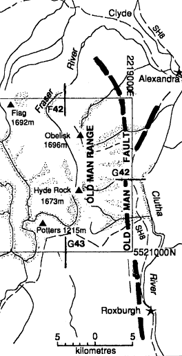
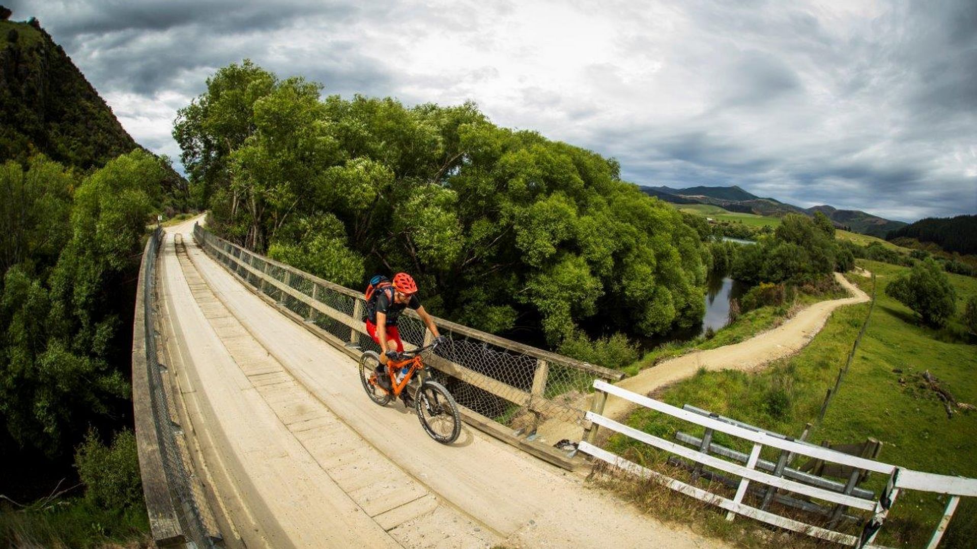
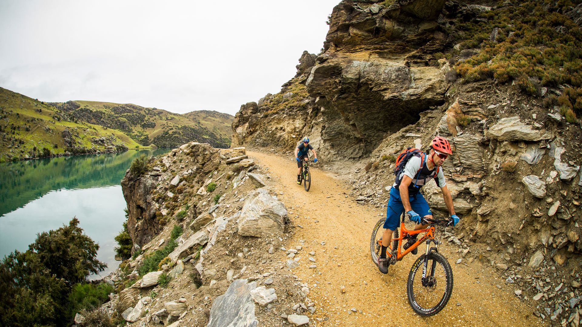
The Roxburgh Gorge is a narrow, steep-sided valley stretching some 30 km between the intermontane basins in which Alexandra and Roxburgh townships are situated. The Clutha Mata-au (Molyneux) River has incised some 100-400 m below the higher standing plateaus of the Knobby Range to the east and the lower slopes of the Old Man Range to the west. The course of the gorge is believed to be governed by regionally significant faults and sets of major discontinuities. The valley is now occupied by a hydro reservoir, Lake Roxburgh, formed by the construction of Roxburgh Dam in the 1950’s. Many creeks and streams from the Old Man Range/Mt Benger (true right) and the Knobby Range (true left) intersect the underlying geomorphology
The Old Man Range comprises an area of uplifted, remnant peneplain. The topography reaches altitudes of 1200-1900m asl and the area is bounded to the east by the Old Man Fault which parallels the Roxburgh Gorge.
The Old Man Fault is a major fault zone (several hundred metres wide) that can be traced from south of Lake Roxburgh to the area west of Alexandra and most of the movements within the zone are Cenozoic (current to 65m year ago) in age.
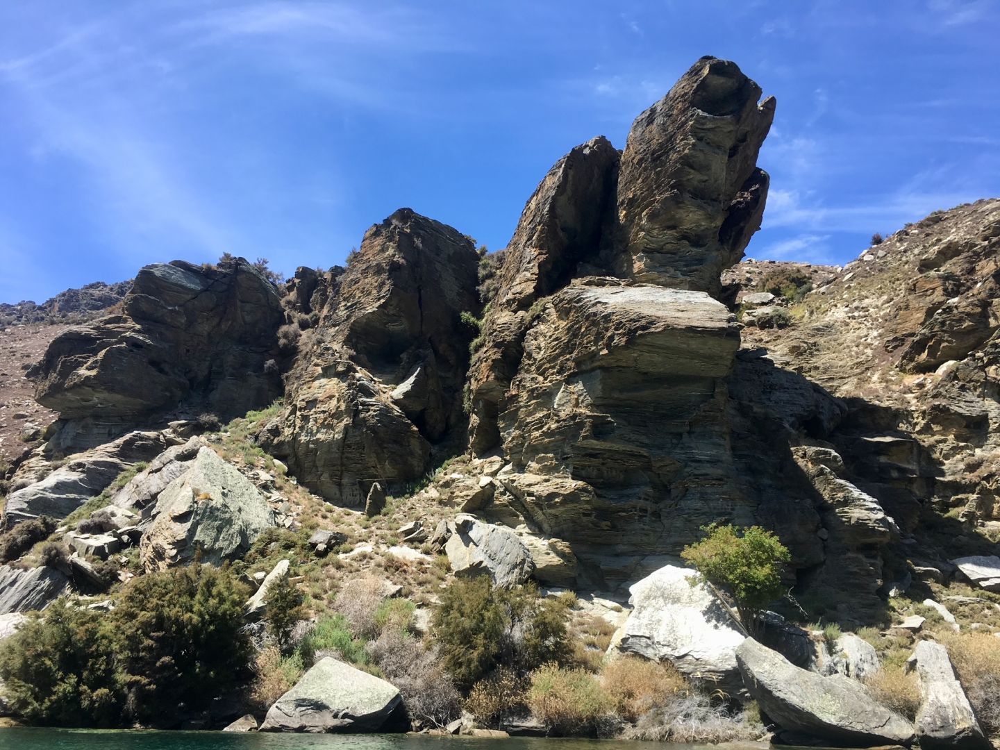
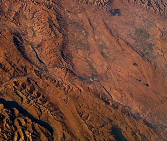
Grey, micaceous schist underlies the Roxburgh Gorge side slopes and surrounding hills, and is significantly weathered by wind, water and frost. Bed-rock exposure is limited within the gorge with extensive landslides forming semi-contiguous deposits on both flanks of the valley. This ‘chaotic debris’ often varies widely in foliation and lineation compared to the in situ bedrock. Alluvial silt and gravel deposits from the receding river and prismatic aeolian loess deposits from post-glacial periods line the sides of the gorge in many places.
On the true right bank beyond Butchers Creek, the Roxburgh Gorge trail traverses the 10 km long Flat Top Hill Slide, the upstream portion of which encompasses a particularly active area of landsliding known as ‘The Narrows’, opposite ‘The Rip’ landslide. This area has some of the steepest and highest slopes in the gorge. Although the overall slope is around 38-40º, there are numerous steeper rocky bluffs and failure scarps plus a shoreline strip over-steepened by fluctuating lake levels. The main phase of land-sliding in the Roxburgh Gorge is believed to have occurred many tens to hundreds of thousands of years ago with intermittent activity since then.
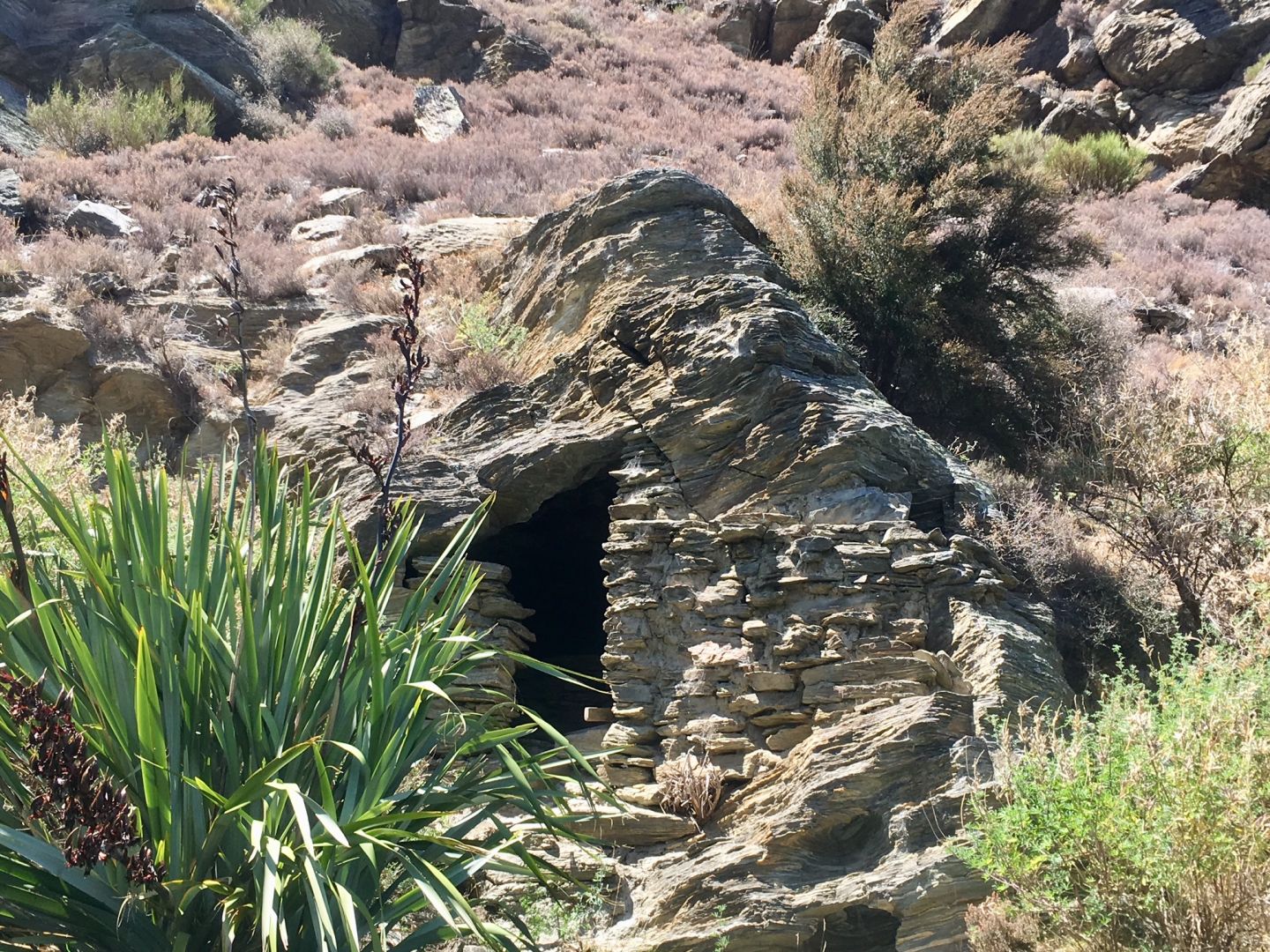
Mining there was restricted by large boulders and a shortage of water, however returns were good and in 1913 gold was discovered even higher up. Heavy machinery was installed but similar problems persisted. Mining resumed during the 1930’s economic depression as part of a government employment scheme when the main race was refurbished using steel fluting and many stone huts were upgraded at the time. Substantial tailings and stonewalled races that provided water from Shanty Creek to the lower workings remain. Some 70m above that a large excavation complete with a cable-crane, a pelton-wheel powered winch and the remains of a tramway still exist. An impressive rammed-earth holding dam with stone buttresses is nearby. There are also remnants and tools of a former blacksmith’s forge site. Near the lake there are three well preserved stone huts and further upstream there is an eel smoking chimney.